For those who are into exploring abandoned and lost trails, or discovering secret places with Acadia National Park, this is a quick take on such places along with links to the blogs on each piece.
People killed in the park; You would think this would be a no brainer, you pick up the phone and make a simply inquiry, "Could you tell me how many people have been killed in the park from falls?" Sounds simple enough, however you quickly learn that the park service doesn't keep such figures. They usually point to a well reported death in the park and follow that up with a statement that there really aren't many deaths that occur in the park. It has been their attempts to down play the deaths in the park which prompted me to begin my blog on Deaths In Acadia National Park. Falling to your death can happen at any time, as too many have already learned, and a moment taken to poise for a photo on the rocky shore can become a life changing ordeal.
DEATHS IN ACADIA NATIONAL PARK
The Green Mountain Railroad Trail; Now to be honest, this was not a trail but the route the cog train used to go from Eagle Lake to the summit of than Green Mountain, today named Cadillac Mountain. However, once the Railroad Company went out of business and the tracks were torn up, locals took over the route and it quickly became a popular hiking trail.
What many don't know is the secret of the Green Mountain trail, as most of the time it is reported that all the railroad spikes and rails were taken up and removed from the side of the mountain. This is not true, in fact the majority of the railroad spikes still remain all along the route, sticking up out of the granite. as for all the rails having been removed, this is also not true. As you get about two thirds of the way up the trail you come to one long section of rail that was never removed.
THE GREEN MOUNTAIN RAILROAD TRAIL
The Great Cave; The Precipice Trail was constructed but not enough people were going there, so it was decided the area needed an attraction to lure more people to the area. A plan was formed to build a Lopp from the Precipice Trail, beginning near the lower section, to a cave that locals called The Great Cave. Once at the Cave entrance, the trail would continue off to one side of the Cave, and run upward and over the cave by way of a long series of stone steps. A metal bridge was built near the top of the loop to help get hikers from one ledge to another safely, where soon after the Great Cave Loop connected to the Precipice trail near the upper section.
The Great Cave must of done its job too well, because years later the Park Service abandoned it.
STORY OF THE GREAT CAVE
The Hanging Steps; Some refer to these hanging steps as one of the great wonders of the National Park, but most have never heard of them, let along been to them. They are located along a section of the Orange and Black trail, a section the Park Service abandoned years ago. They thought by many to be a wonder because the huge stone slabs that make up each step are held in place using iron rods, to make the steps seem to "hang in mid air." and when a park ranger first saw them after their construction, he replied just that, "They seem to hang in mid air," and thus they were named the Hanging Steps.
The abandoned end of the Orange and Black Trail began along an unmarked trail that the Rock Climbing Schools use to go to in order to practice their rock climbing skills. The trail continued past the Hanging steps, making its way upward to the edge of some dangerous cliffs, before entering the woods. Once through the woods the trail came out onto open granite, making its way downward to join up with the Precipice Trail at a spot known as the "Turn Around."
THE HANGING STEPS
The Turn Around; The secret of the Turn Around is how it came to be in the first place, and why the park service see's it as doing its job. The secret is that one place a short ways up the Precipice Trail was designed to get many unexperienced hikers to turn around and go back to the parking lot, and it does that well. The Turn around is a very large boulder with some iron rungs in it, designed to make it hard on people to get up and over that boulder.
With a little knowledge you could get past the Turn around simply by walking up the Park Loop road from the Precipice parking lot and taking the Orange and Black Trail to the Precipice Trail, which joins that trail just above the turn around.
Anemone Cave; Once a popular attraction in Acadia National Park, it was also abandoned years ago. All signs were taken down, map makers were asked to remove it from newer maps, and the railings that once safely helped people down the cliff to the caves openning were removed. So today people risk life and limb to reach the cave which can be entered at low tide. And even though the way to the cave can be slippery, it is even more dangerous inside the cave, which is slimy and extremely slippery.
The ancient sea cave was why Schooner Head Overlook exsists, from its parking lot is a narrow paved path which winds through the woods down to a high cliff. Once you reach the top of the cliff, you are standing on the roof of the cave.
But this sea cave also has another secret, two hikers from the local college became trapped in it as the tide rose, one managed to escape but the other drowned and his body was removed from the cave the following day.
ANEMONE CAVE
The Lost House of Eagle Lake; For many years only the Park Service, its volunteers and their friends knew of this house and its location. It is actually not a house at all, but a huge foundation with a huge arched doorway over looking the waters of Eagle Lake, and large arched windows.
So how did such a majectic foundation come to be, and what ever happened to the house?
There never was a house, only plans for a house. As the foundation was completed, it was George B. dorr, often called the father of acadia National Park, who approached the home builders and convinced them to abandon their dream home.
they did, but left their majestic foundation in place where it sets today, overlooking the lake.
Dorr took this victory and went to the legislature to push for a law to protect such bodies of water as Eagle lake, the Bubble Pond and Jordan forever protected from development. The legislature agreed with Dorr's vision and several bodies of water on the island became protected from development.
LOST HOUSE OF EAGLE LAKE
The Bear's Den; This old Bear's den shows up on old maps long before there was a National Park here, in fact its trail dates back to the days when Bar Harbor was called Eden. When Acadia National Park built the One Way section of the Park Loop Road, a big chunk of the trail was destroyed, but a tiny section remains and leads to the Bear's den, or cave.
The amazing thing is that nearly everyone passing through the park has either driven, hiked or biked through the park has passed right by it and never seen it, yet its hiding in plain sight. Once on the One Way section of the Park Loop Road, drive until you come to a large pond on the right hand side of the road - Champlain Mountain towers over the pond. Continue until you reach the curve in the road up ahead where you will find a pull over, park there.
Now cross the roadway so your on the same side of the road as the ledge wall, and walk a short distance in the same direction as the traffic. Once you reach a spot where the ledge ends and the woods begin, look into the woods and you will see a black area further back with a worn trail leading to it - that is the Bear's Den.
It is so close to the road that when you kneel inside the cave you can see the cars passing by on the Park Loop Road. Back in the days beofre the Park Service put into place a policy of removing bears from the park, it is likely this den was once a home to a bear or two. Than the Park Service began to remove bears from the park and bear sightings were rare. Today, that policy is nolonger in place and bears are as welcome as everyone else, but because the cave is as close to the road as it is, it is very unlikely any bear would reclaim it.
THE BEARS DEN
Compass Harbor; It may well be one of the parks biggest secrets yet it is a mystery why the park service continues to treat the area of Compass harbor like an abandoned area of the park. You won't find any signs there, even though it is perhaps one of the most important areas in the entire national park - it was where the home of George B. Dorr was located. The home was named Old Farm, and to this day the brick floors of the rooms remain in place, along with some sections of crumbling walls.
Not only are there no signs at compass Harbor, the parking lot is tiny and hard to see from route 3. To reach the parking lot you drive down Main Street in Bar Harbor, pass the YMCA and town ball fields, round a curve, and continue a short ways until the road begins to go up a hill, right there on the left is a tiny unmarked parking lot. If you drove past the Schooner Head road or Jackson Labs, you missed it.
The Old Farm Road is just past Compass Harbor, and it has a tiny pull over just large enough for two cars, with a path leading into Compass Harbor.
The only other way to reach it is to go onto the Schooner Head Road and park by Jackson Lab. The Schooner Head Trail begins right by their rear entrance. A short ways down the road is a connector trail which leads through the woods, past a pond, and to Compass Harbor.
So what is the park service hiding there, besides the remains of Dorr's estate? Just before the start of a very long stairway which makes its way up to the top of the hill is a tiny cove. Locals often go there on hot summer days to swim. Compass Harbor itself also has an area where you can swim.
COMPASS HARBOR AND OLD FARM
1
The secret of Lake Wood; Lake what, you might be asking, because many have never heard of Lake Wood, and for those who go there in the summer time, it is in fact one of the parks best kept secrets. Lake Wood is a large lake whose warm waters are a perfect invitation for swimmers. But un like many lakes that offer swimming, lake wood is a bit different. Instead of swimming at the open area below the parking lot, most prefer to walk along either side of the lake to his or her own favorite swimming spot.
Lake Wood also holds another secret, for running along one side of the lake, high up along a ridge, is the start of the Fawn Pond Trail. It may be near impossible to find this trail from the Breakneck Road end, but from Lake wood the trail is well worn and easy to follow.
So where is lake Wood? From Hull's cove, drive out along the Crooked Road, and look for a narrow dirt wood entering the woods with a small park sign by it. The narrow road makes its way to the lake.
LAKE WOOD AND FAWN POND
The Mysterious Stones of Little Hunters Beach;
Is there such a place in Acadia National Park where there are perfectly round and oval stones? If you have ever found your way to the rock strew beach of Little Hunters Beach, than you know the answer already. This is not Hunters beach, which is a larger beach, but Little Hunters Beach, unmarked and easy to miss. I can only tell you the one way you can't miss it, and that is to arrive at Blackwoods Campground. You can take the Free Island Explorer bus from the Bar Harbor Village green, board the Sand Beach bus.
Once you get off the bus, walk up along the camp loop to the far left, you will pass several tant sites on the right, with just woods on the left. A short ways in and you will come to an ocean path which takes you quickly to the one way section of the Park Loop Road. Now walk to the right, its about a twenty minute walk, passing a couple pull overs before you come to a small stone bridge with a wooden stairway leading down the left side of the bridge to a stony beach below. It is un marked, but off in the trees at the top is a sign telling of the beach.
Twenty or thirty years ago when I went there you could find these perfectly shaped and smooth stones all over the place, but people have broken the law over the years and carried the stones home with them, which will get you a date in federal court if you get caught. We were there several months ago and found several nice large ones, perfectly round, the size of bowling balls.
LITTLE HUNTERS BEACH
OLD MAPS OF ACADIA NATIONAL PARK; You asked for them, we went out and tracked them down, a collection of old maps showing abandoned and lost trails in Acadia National Park which no trail explorer should be without.
OLD MAPS OF ACADIA NATIONAL PARK
Acadia National Park in 1932; Ever wonder what was here back in 1932, where people stayed and ate and what prices were back in those times? This gives you a good feel for what it was like back than.
ACADIA NATIONAL PARK IN 1932
George B. Dorr Bike Path and Wild Gardens;
if George B. Dorr had a passion for anything beyond building hiking trails ad creating a National Park, it was for bike riding. It is said he could often be spotted riding his bike along his favorite bike path he created along a section of Indian Pass. He loved his bike path so much he created what would go on to become his famous Wild Gardens of Acadia next to the path. Today only sections of the bike path he built remain, and his Wild Gardens were dug up and relocated to where they are today.
GEORGE B. DORR BIKE PATH AND WILD GARDENS
The Lost Homan's Trail; Okay, to begin with, I am not the one who claimed this trail was ever lost, in fact, for the many years it lay abandoned by the Park Service, I was hiking it a number of those years, so as far as I am concerned, this trail was never lost. That aside, a few years ago the Park service announced the once lost Homan's Trail had been found, a news story was done on it, and even a painting was made. Now if you have ever hiked Dorr Mountain and not done so by means of the Homans Trail, than add it to your bucket list, and be sure to bring along a camera. Once you have hiked it and had a moment to take it on in, ask yourself how such a trail could of ever been abandoned in the first place - it simply boggles the mind.
THE ONCE LOST HOMAN'S TRAIL
YOUNGEST PERSON TO DIE ON THE PRECIPICE;
This is a tragic story of two school girls, both age 12, who climbed up the Precipice one day and how that decision cost one of them their life. This took place in the mid 1850's long before there was a Precipice trail, but even back than people were finding ways to climb the Precipice.
YOUNGEST PERSON TO DIE ON THE PRECIPICE
CAPTAIN KIDD'S LOST TREASURE
Yeah, go ahead and laugh now, but years ago people were not laughing, in fact they were heading for the woods with anything they could dig with in search of this buried treasure. Was any ever found? If it was, no one let it be known. Many years ago I visited the site, now a part of Acadia National Park, and found many signs of old dig sites scattered throughout the woods there. Today, the use of medal detectors is banned in the park as is any digging, so any lost loot still hidden in the woods there will have to remain lost.
CAPTAIN KIDD'S LOST TREASURE
2017 edition Of Our Free E-Book;
Yup, it's finally complete and up for free download. You may find a few blank pages in it, I am still trying to get use to using the free software program. Our 2018 edition will include more trails and more photos, as well as new maps, some of which have begun to appear on some of my blogs. And is always the case, any maps I design are placed into the public domain, free for anyone to repost or use.
2017 EDITION OF ABANDONED TRAILS OF ACADIA NATIONAL PARK E-BOOK
Abandoned Witch Hole Pond Marsh Trail;
Once again yet another abandoned trail hidden in plain sight. This trail is a quick short cut from the Park Loop Road, to Witch Hole Pond and the Carriage road. So easy is it to find, once you do locate it you will never forget how to get back to it again.
ABANDONED WITCH HOLE MARCH TRAIL
THE OLD BUCKBOARD ROAD;
It goes without saying that at one time cars were banned from the island. During those years the only way to reach the summit of Cadillac Mountain was either by way of the Buckboard Road, or by way of the cog train that the Green Mountain Railroad Company operated. The Buckboard Road was also where a gunman dubbed The Gentleman Bandit operated along, robbing from the men only while allowing the women to keep their watches, rings and money.
THE OLD BUCKBOARD ROAD
BEAR BROOK PICNIC AREA TRAIL
Not so much a trail as a connecting path between Jackson Labs, or the Moust Factory as locals call it, and Bear Brook Picnic Area in Acadia National Park. It's about a 3 to 5 minute hike from the lab to the picnic area.
BEAR BROOK PICNIC AREA TRAIL
ABANDONED BRACKEN TRAIL
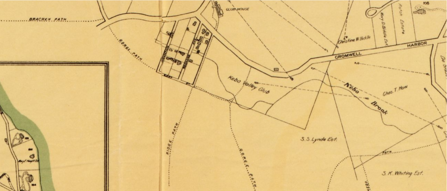
Once this trail served as a major connecting point, allowing hikers to reach trails in Acadia National Park from the gorge Trail end all the way up to the Lake Wood and Fawn Pond End. Than on day the Park service abandoned the Bracken Trail, along with all of the trails to the right of it.
BRACKEN TRAIL
ABANDONED FERN TRAIL
The old gurnee Trail may of once served as a village connector trail between the villages of Bar Harbor and Hull's cove, but it was the Fern Trail that connected those villages to the trail system in Acadia National Park.
ABANDONED FERN TRAIL
EXPLORING BREWER MOUNTAIN
Brewer Mountain has a number of secret and hidden sites on it, just waiting to be found. There is the Stone Tower, as well as two large foundations that served as a sand filtering system for the Bar Harbor Water company, remains of old buildings along with foundations hidden in the woods, and than there is the two granite mining sites.....
EXPLORING BREWER MOUNTAIN
THE STONE TOWER
Imagine walking out of the woods and entering a small field and finding a large stone tower rising up out of the center of the field - that is what happened to me one afternoon and this is the story of the Stone Tower.
THE STONE TOWER
THE WATER PIPE TRAIL
The Water Pipe Trail use to follow the water pipeline from the Park Loop Road up past Great Hill. In recent years the old Cast Iron pipeline was replaced with a more modern pipeline, and you can still locate and follow this route today. As you hike along one side of Duck Brook you will be treated to some nice views of rapids along the way.
THE WATER PIPE TRAIL
ABANDONED GREAT HILL SUMMIT TRAIL
You would not know it today but at one time Great Hill was one of the more popular hiking areas in the in Acadia National Park. There was once several hiking trails on the hill where today there are no official hiking trails. You will also find views on Great Hill that you can't find anyplace else in the park.
ABANDONED GREAT HILL SUMMIT TRAIL
THE GURNEE TRAIL
Abandoned and for a long time thought to be lost, a large section of the Gurnee Trail can still be located and hiked along today, if you know where to look. The Gurnee Trail is not a trail as much as it was once a Village connector path, connecting the villages of Eden, now Bar Harbor, with the village of Hulls Cove
THE GURNEE TRAIL
THE GREAT HILL WATER TOWER
Once the new Bar Harbor Water Company water system went on line, there was no longer a need for the huge water tower, thus it was abandoned and lies hidden in the woods on the side of great Hill. It is a short hike and fairly easy to find once you know where to look for it.
THE GREAT HILL WATER TOWER
THE GREAT HILL RESERVOIR
In the woods on the side of Great Hill, over looking the Duck Brook Bridge Road, lies an abandoned reservoir. It is about a two minute walk up to it, yet few have ever seen it.
THE GREAT HILL RESERVOIR
THE LOST RUDOLPH BRUNNOW TRAIL
This abandoned trail took a bit of leg work to track down, but it was well worth the time and effort. Old maps don't give this a name, so we did, though recent research suggests this may of once been a section of the Orange and Black Trail which may of been abandoned due to rock slides, with the main trail being rerouted.
THE LOST RUDOLPH BRUNNOW TRAIL
MOUNT DESERT ISLAND PHOTO COLLECTION
Some of the photos I have taken over the years of Mount Desert Island and Acadia National Park.
MOUNT DESERT ISLAND PHOTO COLLECTION
This is the original start of the Gorge Trail, most likely abandoned by the Park Service because the trail passed along private property, in some areas over private property, and the land owners did not want people crossing their land. This trail is not hard to locate and today comes out onto the official extended Gorge trail, close to the Cadillac North Ridge Trail.
ORIGINAL START OF GORGE TRAIL
ABANDONED BASS HARBOR LIGHTHOUSE TRAIL
I first located this abandoned trail on an old map, which has a small stony beach the locals call Whistlers Beach. There is also a nice stretch of the trail where nice pieces of drift wood wash ashore.
ABANDONED BASS HARBOR LIGHTHOUSE TRAIL
An old trail that most likely connected to the old Gurnee Trail at one time. The widening of route 3 and the building of two bridges pretty much erased a large section of this trail, yet some sections of this trail can still be located today for the adventurous explorer. After doing further research we discovered the secret behind how the early hikers of this trail were able to get past the really rough sections, a series of wooden covered bridges criss crossed the brook in different areas, without the aid of those bridges, today hiking the length of this old trail is a real challenge.
DUCK BROOK TRAIL
ABANDONED CRASH SITE OF CEDAR SWAMP MOUNTAIN
For reasons only known to the experienced Air Force Captain and pilot of the plane, he decided to fly into bad weather, into rain and fog, when the plane suddenly vanished. Three months later his body was recovered, but the wreckage of the plane still remains on the side of the mountain.....
ABANDONED CRASH SITE OF CEDAR SWAMP MOUNTAIN
THE SHIP WRECK SITE AT SEAL COVE
The wreckage of a large ship is discovered in a small cove and a mystery begins on what the name of the ship was and how did the large ship get to where its remains lie today. Seal Cove is the setting for this mystery and the ship wreck has been documented, yet the mystery of the ship still remains.
THE SHIP WRECK AT SEAL COVE
KEBO MOUNTAIN GRANITE MINING SITE
Not so much an abandoned trail as it is an abandoned road, I had come upon this old road many years ago and never followed it. Today we now know from evidence found near the end of the road that it was once a granite mining site. The photos show what appears to be rusting parts from some type of equipment used at the location.
KEBO MOUNTAIN GRANITE MINING SIRE
ABANDONED MCFARLAND MOUNTAIN SKI SLOPE
When I first read that Bar Harbor was once the home to a ski slope I found it hard to believe, but after doing some research I learned more about the operation and what remains of it on McFarland Mountain in Acadia National Park. By one of the supports for the chair lift that was used at the site is a large power box, as can be seen in the photos.
ABANDONED MCFARLAND MOUNTAIN SKI SLOPE
BUILDING OF THE ARTS
Long before the great fire of 47, there was the Building of the Arts, a
building in which serious lectures and art shows was held at. It also
was a place were many very famous people of that time came to perform on
stage. In fact a young and upcoming actor named Henry Fonda performed
on stage, and president Taff golfed in the shadow of the building. The
photos at the link below show just how grand and majestic the building
of the Arts was, yet no one back than could of known just how big of a
role World War 2 would play in the buildings future.
THE BUILDING OF THE ARTS
THE ROCKEFELLER BOAT HOUSE
I came across the Rockefeller Boat House one day while hiking in the rain some forty years ago, it was an amazing building than and it still is today. At the time I thought I was approaching some one's house, and once I realized what it was, even in the rain it was a beautiful sight. There is a kind of poach or walkway along the sides of the building with railings where visitors can walk out along, with beautiful views of the pond. Even though the site is open to the public, I believe they may not publicize the site much because they may want to keep the number of people visiting the site down, but that's just a guess. It is not a very long hike to reach the boathouse and if your in that area put it on your to do list.
THE ROCKEFELLER BOAT HOUSE
THE DEER BROOK TRAIL AND STEPHEN KING
The Deer Brook Trail, one may say, has deep roots as part of its history in Acadia National Park. I can make that statement with certainty because it was the large old twisted roots found along this trail that caught movie producers eyes and found their way into a very popular Stephen King movie. The name of the movie most would recognize, Pet Cemetery.
sadly today those roots no longer exist, they were removed by the national park Service during a trail rehabilitation project. Check out the link below to see exactly where in the movie the old roots appeared in...
THE DEER BROOK TRAIL AND STEPHEN KING
"Schistostega Cave."
I learned about this little known cave while reading a very old copy of the bar Harbor Times. It stated that while many of the children in the area knew about the cave, very few adults knew about it. Some people also call the cave by another name, Goblins gold. The cave itself is on Bald Porcupine Island, and can only be reached with the aid of rope. The opening is small, and the further you go into the cave, the smaller the space in the cave becomes.
A group of scientists visited the cave to gather samples of a very rare moss that grows in the cave, a moss that glows with a very bright green light. One scientist in the articles stated, "Once you have seen this strange glowing moss, you will never forget it." The moss samples were gathered with the aid of children who had to go deeper into the cave in order to gather the moss. The moss was than taken to Jackson Labs to be examined. when asked how deep the cave was, one scientist said it was at least 100 feet deep, and at that point a flashlight was aimed down into the cave and the end still could not be seen.
"Schistostega Cave."
GHOSTS HIDDEN IN PLAIN SIGHT - Acadia National Park
What determines when some ones soul passes on to the world beyond or gets left behind, trapped in a place with no way out? And do such places exist in a places as beautiful as acadia National Park? Many know Anemone Cave as a site to explore at low tide, but most do not know the caves first name, or the many deaths connected to it.
GHOSTS HIDDEN IN PLAIN SIGHT
THE DORR MOUNTAIN CREVICE CAVE
It may be hard for many who have hiked up along the Dorr Mountain Trail, but there is a crevice cave hidden in plain site that many hikers never see. This cave clearly was once a part of the Dorr Mountain trail, as the top opening of the cave has two large stone steps leading down into the entrance of the cave. I first discovered this old cave from a video that was placed on Youtube.
DORR MOUNTAIN CREVICE CAVE
STORIES FROM THE PAST
A collection of old newspaper stories from the past, from automobiles first being allowed on Mt Desert roads to vandals removing a section of Tilting Rock to a brutal murder.
STORIES FROM THE PAST
MAINE HOUSING REVIEWS
Looking to move to the state of Maine or looking for a new apartment in Maine, than check out some of the apartment reviews in this blog. Some of the reviews even have the floor plans of the apartment and photos to help you decide which apartment is best suited for you.
MAINE HOUSING REVIEWS
THE POETRY OF J.R. LIBBY
Over the years I have had four chapbooks published and a number of my works have appeared in over a dozen small press publications. Many of my poems are drawn from real life experiences with a number of my poems having a tongue in cheek feel to them. Some of my favorite works are the ones that deal with rural Maine and rural living.
THE POETRY OF J.R. LIBBY
Check out my son's online store at Zazzle...he has some pretty cool gift ideas