Tuesday, December 23, 2014

MY FIRST EBOOK IS NOW AVAILABLE FOR FREE DOWNLOAD

This is my first ebook on the Abandoned trails of Acadia National Park and is what will be the first of two books. 


Click  HERE for free download


Monday, December 8, 2014

THE HOMANS TRAIL IN ACADIA NATIONAL PARK

Dorr mountain is a very popular mountain to hike, but what many hikers don't know is just around the corner from the main hiking trail is the Homans Trail.  The trail was a bit of a mystery from the start - it was built to climb high up the side of dorr mountain, using stone steps for most of the way, and it suddenly ends.  Some named it The Stairway To Nowhere.   and after the great fire, when the park service began abandoning many of the popular hiking trails in the park, the Homans trail also was abandoned.  Over the years it became the forgotten trail, until it was re-discovered in recent years and reopened.

The Homans Trail - Acadia National Park


If your going to hike Dorr Mountain - hike this path, and bring along a camera.  But before you can hike the Homans trail, you first have to find it.  Like I said, it has now been reopened, but the trail head could not be in a worse spot. To locate the Homans trail, you need to drive to the Sieur de Monts Spring parking lot, where the Wild Gardens of Acadia National Park and the Nature Center are also located.  You can reach that area three ways, off of route 3 as your heading toward Otter creek, or along the One Way section of the Park Loop road, signs let you know when your there.

Homans Trail - Acadia National Park


The other way to get there is by catching one of the Island Explorer free buses from the Bar Harbor village Green.  You want to board the Sand Beach Bus - Sieur de Monts is one of its stops.
Once at the parking lot, go to the far end of the parking lot, to the right - where you will find a fire road with a gate across it.  Follow the fire road until you come to a four way intersection, there will be a trail to the right that's a boardwalk running through the woods.  Keep going straight, about a car length or two, and you will see the trail head sign for the Homans Trail.

View from Homans Trail - Acadia National Park


The trail curves through the woods a short ways before coming to the first steps.  After a short ways the trail comes to a cool spot where one has to bend low and pass through a hole in the granite - make sure not to bump your head as your passing through it.  On the other side the trail turns to the left and begins its climb up the mountain side using stone steps.
Soon you come to the next amazing spot on the trail, a very narrow passage that passes between two huge walls of granite.  By itself that would be neat, but when the trail was built, George B. Dorr, the founder of Acadia National Park, had work crews place a huge section of granite over the top of this narrow passage, and you almost feel like your passing through a cave.


Dorr Mountain Trail - Acadia National Park


Stone steps continue to rise upward until you reach the place where the trail use to end.  There are some fantastic views along this path, but the best view is still up ahead.
I believe the park service has added a connector path from this to the most popular trail up dorr mountain, but if not, everyone follows a worn path to the left, just a short ways to the more popular path. 
Once on the main dorr Mountain path, continue onward to the summit, which is still some distance away.

Dorr Mountain Trail - Acadia National Park

Where that worn path meets the other trail, that is where you get an amazing view and you want a camera with you.


Homans Trail - Acadia National Park

Tuesday, December 2, 2014

THE MISSING GATE HOUSE OF ACADIA NATIONAL PARK

One of the Gate Houses in Acadia National Park is missing - have you seen it?  Actually, the missing Gate house is missing for a very good reason - it never got built.   The Rockefeller's owned the land by Eagle Lake and it was their intention to build a third Gate House there, this one would include stables and a saddle station.  But the lake was the source of the town's drinking water and they refused to grant a building permit for the third gate house.
Pictured is the Jordan  Pond gate house.

Jordan Pond Gatehouse -
Acadia National Park


Had the third Gate House been built, we can only imagine how beautiful it would of looked with the lake as a backdrop.
By the way, if you want to take a tour of the inside of one of the two Gate Houses, check with the park - once or twice a year the Jordan Pond Gate House if open to the public. 

Monday, December 1, 2014

ACADIA NATIONAL PARK IN 1932

I got lucky, my brother in law collects old stuff on Maine Trains and was going through his collection when he came across something he thought I might be interested in.  Thought I would share it.


Friday, November 21, 2014

THE GREEN MOUNTAIN RAILROAD PATH

Once upon a time, as the children's story goes, "There was a little train that could."  Well, in the 1800's there was just such a train, and it was called the Green Mountain Railway.  It was a small cog train that ran from one end of Eagle Lake up to the summit of green Mountain- renamed later to Cadillac Mountain.  The company would go bankrupt and the rails and tracks were torn up and sold, but the railroad spikes had to remain in place because they had been driven so deep into the granite of Cadillac Mountain they could not be removed.  And though accounts state all of the rail was removed, this is not the case, one sole section of rail remains in place on the side of Cadillac Mountain.  The path the train took remained very popular with hikers for many years after that, until it was abandoned by the park.
Cadillac Mountain - Green Mountain Railroad Path - Acadia National Park


The Green Mountain Railroad - Acadia National Park

  It took me a few years of searching for it off and on, and one afternoon we ended up tripping over a railroad spike in the brush.  That's how I located it, anyways.  One big problem was that on Google Books, one account states it knows the location of the lost trail, and than goes on to give the wrong  information. 
Once the railroad company went out of business, and all but one section of rail was removed, people still  hiked along the train route to reach the summit of Cadillac Mountain.  It was treated for many years there after as if it had been an official trail.  But over the years the wide path through the woods and up the mountain side slowly began to become overgrown, and partly through park efforts, branches and tree limbs found their way onto the trail, so the once popular hiking route began to fade away.  Amazingly, after all these years of neglect, the trail is still in pretty good condition, marked along much of the route by railroad spikes sticking up out of the granite.  The trail is easiest to locate along the Park loop road, and begins in the woods on a knoll about half way between the Cadillac Summit Road and Bubble Pond.  On a calm day you can hear the rushing waters of a nearby stream.


The Green Mountain Railroad - Acadia National Park

Once in the woods and up the knoll, the path is at an angle to the left, there is usually a tiny rock pile by a railroad spike, and the ground there will be worn down as it leads up into the woods.  There are very few railroad spikes on this end, but there should be a rock pile here and there, and the further you go the more worn the trail becomes.  At a couple places the trail may seem to end, just keep in mind for the most part, the train tracks ran in a straight line, turning direction only once, so if the trail seems to end at a tree or two, simply look on the other side of the tree's, and the trail will be right there.
Now there is one spot o the lower end where there is a section of brush you have to cross, walk straight ahead in the same direction you were walking.  Not far ahead of this section is one of the surprises you will come upon - a section of railroad bed built up along a rising cliff.  Once you get there, the trail is really easy to follow because now more and more railroad spikes can be seen.  It is also at this point the trail begins to get very slippery in places - I suggest you wear something with good footing.  The granite is covered with moss made slippery from over flowing waters from a nearby brook.  The Trail also begins to climb more here.  Up through and under some tree's, and your not far from the next surprise.


The surprise is walking through a line of tree's and suddenly seeing that lovely piece of rail that is still on the mountain side.  At this point everywhere you look you see piles of rusting railroad spikes, the few they did manage to remove, and than simply left behind in small piles.
Here the trail slopes upward some more, and at first the granite appears to be safe to cross - but in all the times I have hiked this trail, this area is more slippery than any before it.    From here the trail enters and exits the woods a few more times, before the granite gives way to dirt, and the trail is very easy to follow without the aid of spikes.  But just when you think things are going to good, the trail suddenly ends by thick brush and woods.  Clearly the brush has grown up over the trail here and it can't be seen again.  At this point your not very far from the Cadillac Mountain Summit road - either walk straight ahead for a short ways until you come to the summit road, or wait until you hear a passing car and walk toward its sound.
Cadillac Mountain Railroad Spikes - Acadia national Park
At this point you can either go right and follow the summit road a short distance to the summit of Cadillac Mountain, or turn and head left down the summit road to the park loop road.  Once at the park loop road, turn left, and head for the second pull over where you parked.


They say the hike is a moderate one, and I would agree, I would also warn anyone attempting it that the trail can be very slippery in places and I know of one hiker who slipped and banged up their knee. 
In days gone by, the train went beyond this point, not much beyond, to where a tavern was located on the summit.

Green Mountain Railroad Trail - Acadia National Park


The bottom section has now also been located, though its no way close as scenic as the upper portion.  It is however well hidden.  We located the beginning point of the lower section by crossing the Park Loop Road and making our way down the embankment directly across from knoll where the upper section begins.  You only need to go down into the brush a short ways not far from that stream to locate a gully, if you follow the gully you will soon discover railroad spikes as you make your way down toward Eagle Lake and its carriage road.   At the start of the gully we found several fallen tree's and branches, but walked around that first section and went down into the gully.  We followed it down hill and came upon a number of places where we found old railroad spikes sticking up out of the granite.  At one point the gully comes closer to a nearby stream and we crossed over to it and found a nice little water fall.  The gully soon ends and from there you can see the eagle Lake carriage road, the lake, and just to the right a wooden bridge on the carriage road.
Sadly we found no evidence of railroad spikes near the lake edge, nor any sign of an old pier, but after searching for a long time, it was nice to finally be able to add the lower section to the upper section of this once very popular hiking trail.


CADILLAC MOUNTAIN SUMMIT ROAD
"Fun Times In Acadia"
Acadia National Park


VIDEO OF THE GREEN MOUNTAIN RAILROAD TRAIL 


 HISTORY OF THE GREEN MOUNTAIN RAILROAD


A DEATH ON NEWPORT MOUNTAIN


BAR HARBOR TIMES
March 26,  1924
The Tragedy Of Newport Mountain

To the Editor of the Bar Harbor Times;
I was very much interested in the article and the poem in a recent issue of the Times from Mrs. Smith nee, Miss Jennie Lynam, and it brought to my mind the tragedy of Newport Mountain of long ago, almost forgotten now but which at that time was an awful thing to happen in that quiet little fishing village.  For a long time as a boy I remembered the date, as the story told to me by my father left a very strong impression on my mind, but the years have gone by and I have forgotten but it must have been just previous to the civil war.
One beautiful morning in blueberry time, the men and boys were about all away fishing;  some of the women and girls made up a party to go to Newport after blueberries;  a good early start was made.  Among those who made up the party were two beautiful young girls about fourteen years of age, almira Conners and Leucretia Douglas, near neighbors at Cromwells Harbor, Miss conners living in the so-called Zack Bijar Higgins house that stood on the spot on the Dorr estate, where was built the house that Charles Southard lived in while caretaker for the Dorrs.   Miss Douglas lived in an old house that stood on the spot on which Gardiner Sherman built first.
The Precipice - Acadia National Park
The happy little party had a nice time and after they had all partaken of a late lunch it was decided to start for home.  The two girls mentioned had chatted and talked so much that their pails were not as full as the others, so they decided that they would stay a while longer and fill their pails.  The older ones demurred at this.  Finally it was decided that the two come to the path and pick along the side of that, and the others went home.  They picked along under near the edge of a steep bluff they both espied a beautiful bunch growing near the edge and both made a run for the spot.  As they reached it an awful roar greeted their ears, and they both went off into space.  Miss Conners was lucky enough to catch a limb in her fall and escaped with a broken arm and some scars which she carried to the grave with her, but fate had ideereed otherwise for Leucretia.  She went to the bottom of the cliff, and her life was crushed out by a large piece of falling rock.  When the girls did not return a searching party was made up and everyone who was able to go searched all night, with what few lanterns they could procure, and built fires but without success.
Mr, Lynam, father of Miss Jernie, Charles and John, wencing his way very early that morning to the upper meadow at Schooner Head to mow while the dew was on.  As he neared the place where his days work was to commence, he heard faint cries, curious as to what it might be, that sturdy old pioneer lay down his scythe and started to investigate.  As he drew nearer the cries became fainter and fainter and finally ceased altogether, but he had become convinced that it was a person in distress and soon he saw an object like a body hanging in the tree.  Not being able to reach it alone he went back to the house.  By that time some of the people had come to his house and told of the two missing girls.  They immedeately gathered ropes and ladders and went up the side of the mountain, by no means a safe thing to do.  Miss Conners was rescued in an unconscious state, and taken to her home where she soon recovered.  They than went to get the other girl and had to pry the rock off her body.  It was afterwards said that she did not die until nearly morning.  Mrs. Higgins, who was the other girl, told that she heard Leucretia until sometime near morning when she herself became unconcous.  Miss Leucretia Douglas was my father's youngest sister and Miss Conners became the wife of Charles Higgins and the mother of Dr. Herbert Higgins.  Everyone that I ever heard tell the story always spoke of the splendid grit and courage of this Mr. Lynam had.  It who as I remember must of been quite an old man at the time.
           J. Sherman Douglas


Lucreatia K. Douglass
And now, the poem and article that Mr. Douglas was replying to;

BAR HARBOR TIMES
May 27,  1887

(from the Eastern Freeman, 1853)
Lines on the fall of Lucretia K. Julia Douglass, aged eleven years, four months, and Elmira F. Conners, aged ten years, from one of the heights of Newport Mountain, on the island of Mount Desert, August 3, 1853, which resulted in the death of the former.  The latter was rescued by her grandfather Lynam and others.

Historic Muse whose ponderous book
contains the facts of ages past,
thy office is with watchful eye,
to mark their current to the last.

How vast the sphere on thy command,
what themes within thy knowledge fall!
Or joy, or grief, or gain or loss,
thy faithful pen records them all.

Accept the tribute which we bring,
nor let out tears unbeeded flow,
those guardians of our children's weal,
partake of a parent's woe.

Yon mountain rising in the east,
has oft embraced the morning ray,
but never in his long, long reign,
behold the close of such a day.

The sun had turned her western way,
and left the shadows on the vale,
and all was lovely till the scene
was changed by sorrow's fearful wail.

Grandfather's name with piteous cries,
rolled sad along the craggy steep,
Grandfather ran and rescued her,
while one remained in her last sleep.

Night came - dark night, and all was well,
save when the breezes made their moan,
or when the neighbors footsteps broke
the silence reigning through the gloom.

They said she mat be yet alive,
we'll go with lights and bring her home,
but she was laid in death asleep
where man nor beast had ever come.

The fishermen of Frenchman's Bay,
beheld the fires, but did not know
their friends were seeking for the lost
amid the rain on Newport's brow.

Well might the heavens weep that night
sweet innocence lay in her flood,
but unrelenting, ragged rocks,
were only footsteps to her God.

The morning came Lucretia's fate
was still in deep, dark mystery bound.
Elmira Conners said she lay
above the place where she was found.

The neighbors stood with awful gaze,
and looked upon the fearful cleft
than at the peril of their lives,
they found the trust with angels left.

With mournful pleasure we have left
her dust with Him who that will save,
and ask of death where is thy sting?
And where's thy victory, boasting grave?

And when some cloud o'erspreads the sky,
and throws its darkness all around,
you leave the vendure green behind
so may this providence be found.

Infinite goodness cannot err,
infinite wisdom does no wrong,
good when he gives, good when he takes,
His rule deserves our constant song.

submissive  is a Father's hand,
this lesson well becomes our heart,
through life's brief day O, may we seek,
and find by grace the better part.

The young lady who was killed by the fall was a sister of Mr. John H. Douglass of Bar Harbor, the one who was rescued afterwards became Mrs. Charles Higgins and the leader of the rescuing party was the father of Mr. John Lynam, of Lynam's Hotel.  The verses were written by Mr. Douglass, father of the unfortunate young lady.

Map of The Precipice - Acadia Nation al Park
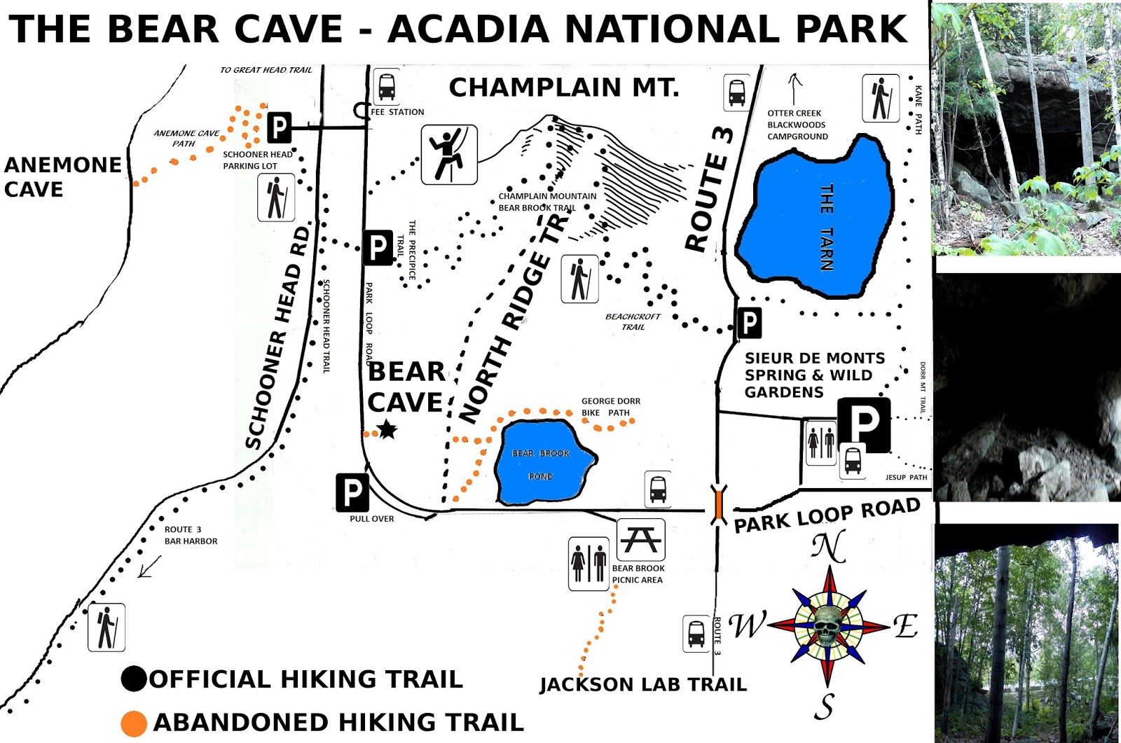
The girl's gravestone states she was age 12 at the time of her tragic death, but everything I have found on this tragic death states she was almost 12.  I was doing research on the Great Cave when I came upon an old map showing about where the cave was located on the side of the Precipice, and noticed an X above the cave area and the words, spot where young girl fell to her death.  This would of placed the two girls just above the cave along a very high cliff.
Today a path along that area is an abandoned section of the Great Cave Loop and that dirt path very well may of been the path the yound girls were picking blueberries along.  While picking berries the group of women and girls stopped for lunch, and old piece I came upon in an old book at the COA stated that the Great Cave along the Precipice was a favorite spot people went to for picnics, that does not mean they had lunch at the Great Cave, I merely point this fact out.  They clearly had lunch somewhere along the mountain side.  Back than Champlain Mountain was named Newport Mountain.
If you have never experienced the side of a mountain or cliff suddenly give way, it is something you will never forget should you experience such a thing.  One day while following the base of Great Hill, as me and my oldest son Wesley were making our way forward, the entire side of the cliff suddenly gave way and rocks and boulders came crashing down in a cloud of dust and it sounded like thunder and had we advanced another 12 years we may very well of been buried alive.

Lucreatia K. Douglass was the daughter of Rev. William S. Douglass and Priscilla Douglass.  She is buried in the tiny cemetery named the Mount Desert Street Cemetery in Bar Harbor, Maine - where her gravestone rests between two churches.  Her parents are also buried there but they have no stones.  From my research I learned her parents did not have much money and at the time of her death she lay for several years in an unmarked grave.  One day a brother returned to the village and purchased a stone for his sister - this is stated at the bottom of her gravestone.  One piece I found on her death stated that her parents went to the site of where she died and placed a wooden cross there.
Even though all the deaths which have taken place on the Precipice are tragic, this has to be one of the more tragic deaths to have taken place there.

And the following was copied from The Mount Desert Street Cemetery website;
DOUGLASS
   E. Woodman (son of John H. [no stone] and Margaret[t]2 H.) - d. 23 August 1881 Æ 9 m., 26 d. (gravestone)
   H. Emery (son of John H. [no stone] and Margaret[t]2 H.) - d. 12 July 1880 Æ 1 y., 2 m., 12 d.3 (gravestone)
   Lucreatia [sic] K. (dau. of Rev. William S. and Priscilla [no stones]) - d. 3 August 1853 Æ 12 y.; (“was killed by falling from Cliffs on Newport Mt. Eden Me.”) (gravestone)
   Margaret[t]2 H. (wife of John H. [no stone]) - d. 2 March 1887 Æ [1?]8 y.3 (gravestone)
   Mary Alice (dau. of John H. [no stone] and Margaret[t]2 H.) - d. 4 January 1885 Æ 7 y., 5 m., 27 d. (gravestone)


Tonight I came across a newspaper story about this tragic death, published in the Bar Harbor Times, July 16, 1959. In the article it states there are no longer any records that refer to this girl's tragic death, but it is considered the first recorded death of a hiker on a mountain on Mount Desert Island. At the age of 12 it would also make her the youngest hiker to die on a mountain on Mount Desert Island.

TRAGEDY ON NEWPORT MOUNTAIN video

DEATHS IN ACADIA NATIONAL PARK


Wednesday, November 19, 2014

STORY OF THE GREAT CAVE OF ACADIA NATIONAL PARK

The story of the Great Cave begins with the building of the Precipice Trail, designed and built by Rudolph Brunnow, a man who was famous for constructing difficult and challenging trails.  When faced with the prospect of constructing a trail up the side of the Precipice, he was faced with a real challenge, but one he readily took on.
But once the precipice was constructed, Rudolph Brunnow was faced with perhaps as big of a challenge as the building of the trail itself - how does one attract people to a trail that was on a less popular area of the Park?  The task now facing him was coming up with a way to do just that, and his plan involved building a series of trails in the area of the Precipice.


Acadia National Park Trail Map

Map of The Great Cave - Acadia National Park
Other supporting trails he built was the Orange and Black Trail, The Beehive trail, the Murry Lane Path, and the red Trail, today renamed the Schooner Head Trail.  But he still needed a main attraction, and thus he seeked permission and got it to construct a loop trail up to the Great Cave.  The Great Cave loop began around the same area where the Orange and black trail connect to the Precipice Trail today.  It follows a boulder field upward toward the woods, and just inside the woods the well worn Trail continues up to the entrance of the Great Cave.
Great Cave Steps, submitted by Nick Thorndike

Off to one side of the cave, and you do have to look for it, is a hidden stairway leading up above the cave, where it comes to cliffs.  There is a metal bridge and iron hand rails to help you along the narrow cliffs, and the loop ends at the base of where the Ladders begin up the official precipice Trail.
It was David Schortmann who went out and located and documented the Great Cave, he had found half of the missing Great Cave Loop, and I wrote how we now need some one to locate the other half of the loop.  Not long after I was contacted by Nick Thorndike, who had discovered the nearly hidden stairway and send me a photo of it.  So we now had the complete Great Cave Trail documented.  The finishing touch came when I got an email from Zhanna Galas who went up and got us the GPS numbers for the site.


The Great Cave - Acadia National Park
  As you can see, like minded adventurers play a key role in uncovering some of these abandoned trails, and for them we are very thankful, because without their efforts some of these trails would remain lost to this day.  Not in this book nor on the website do we name everyone because for various reasons some do not want their name made public, so rather we know their names or not, we own them a big thank you.


ABANDONED GREAT CAVE OF ACADIA NATIONAL PARK
The above photo was submitted to one of my sites on the Great Cave by David Schortmann.
Rudolph Brunnow was a master trail builder, as anyone who has climbed or walked his trails will attest to. 
But he never could of seen the day coming, long after his death, that the Park Service would take aggressive moves and close down some of his greatest works.  The Great Cave Loop trail was abandoned, as was a nearby other trail he constructed.  Nearly half the Orange and black trail was also abandoned and the Schooner Head road red trail was also abandoned.  Rudolph Brunnow had plans to extend the red Trail from Schooner head up to the area of sand beach, to connect it to the Ocean shore path - for whatever reason those plans never came to be.


THE GREAT CAVE - ACADIA NATIONAL PARK
The above photo was submitted to one of my sites on the Great Cave by David Schortmann.
In an old book at the COA I came across a piece on the Great cave, way back when I first began to search for its location.  It stated the Great cave was one of the worlds great wonders, and that the mouth of the cave was 100 feet high and 100 feet wide, and ran about 100 feet back into the mountain side.  The piece went on to say the cave was so large one could fit a plane inside it, which if true would really make for a really Great cave.  Perhaps one could fit a plane inside the Great cave, providing one carried it up there in pieces.  Not to say that the cave isn't great, because everyone who has been to it agree, it is indeed a Great cave and worth the hike.
It is worth noting that even though the Great cave no longer appears on trail maps, it is still very much there.  As trails are abandoned, the park service asks map makers to remove them from future maps, thus todays maps do not show abandoned sites like the Great Cave, Anemone Cave, The Bear's Den, the Hanging Steps, the Gurnee trail and other abandoned sites.

GPS for The Great Cave
Talus Slope along Precipice Trail
44.349697 - 68.189670
Split with Official Precipice Trail
44.349656 - 68.189792
First Sign of Trail in woods
44.349473 - 68.190019
Stone Steps to Cave
44.349164 - 68.190296
The great Cave
44.349101 - 68.190362
(supplied by Zhanna Galas)


To learn more about the Great cave, visit one of the links below.

LOST AND ABANDONED TRAILS OF ACADIA NATIONAL PARK

DEATHS IN ACADIA NATIONAL PARK

LEAVE THE WORLD BELOW


Wednesday, October 22, 2014

MAP OF BEAR CAVE - ACADIA NATIONAL PARK

You will find the words  BEAR DEN on old maps that date back to before Acadia National Park was founded.  Back than Bar harbor was named Eden and the bear cave or den, was a trail the locals liked to hike.  Since there was no park, let alone a park loop road, it took us a while to finally locate the bear cave, and as it turned out, I had passed right by it many times without ever knowing it was right there, tucked in behind the trees.
But it was not me who actually located the den, but my oldest son Wesley, who I had told me and  my youngest son had been out searching for it for some time.  He went out the next day and found it, and got back to me with the information which enabled me to find the site.

CHAMPLAIN MOUNTAIN - BEAR'S DEN - ACADIA NATIONAL PARK


To locate the bear cave, drive along the ONE WAY section of the park loop road, like your heading to Sand Beach.  You will pass the turn off for the Wild Gardens of Acadia and the Nature Center, stay on the park loop road and continue driving until you come to a pond on the right hand side of the road - you can't miss it.  Drive pass the pond and park at a pull over on the left and side of the roadway just up ahead.
Now walk down the side of the roadway, on the right hand side of the road, until you reach the end of the ledge, where you can look into the woods.  You will see a large dark shadow in the tree's, this is the opening to the bear cave.  A well worn but unmarked path leads to the opening.